Note: This document is for an older version of GRASS GIS that has been discontinued. You should upgrade, and read the current manual page.

NAME
d.rgb - Displays three user-specified raster maps as red, green, and blue overlays in the active graphics frame.KEYWORDS
display, graphics, raster, RGBSYNOPSIS
Flags:
- -n
- Make null cells opaque
- --help
- Print usage summary
- --verbose
- Verbose module output
- --quiet
- Quiet module output
- --ui
- Force launching GUI dialog
Parameters:
- red=name [required]
- Name of raster map to be used for <red>
- green=name [required]
- Name of raster map to be used for <green>
- blue=name [required]
- Name of raster map to be used for <blue>
Table of contents
DESCRIPTION
d.rgb displays three user-specified raster maps as red, green, and blue overlays in the active graphics frame.RGB stands for red, green, and blue. d.rgb visually combines three raster maps to form a color image. For each map, the corresponding component from the layer's color table is used (e.g. for the red layer, the red component is used, and so on). In general, the input raster maps should use a grey-scale color table.
NOTES
d.rgb does not attempt to quantize the combined image into a fixed number of colors. Nor does it have an option to generate a composite layer (see r.composite for that). The image and raster maps will not display properly if the graphics device does not have a reasonable sampling of the RGB color-space.If color quality of satellite image color composites seems to appear poor, run i.colors.enhance on the selected satellite channels.
An alternative is the assignment of grey color tables to each band with r.colors:
r.info -r image.1

min=0
max=255

r.colors map=image.1 color=grey

r.colors map=image.2 rast=image.1
r.colors map=image.3 rast=image.1
To write out the color composite to a combined R/G/B raster maps, use r.composite.
EXAMPLE
Visual color composite of a LANDSAT scene (North Carolina sample dataset):g.region raster=lsat7_2002_10 -p d.rgb blue=lsat7_2002_10 green=lsat7_2002_20 red=lsat7_2002_30
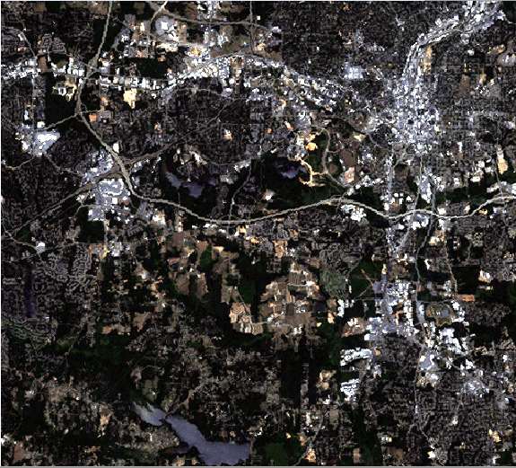
Figure: Visual color composite of a LANDSAT scene (North Carolina sample dataset)
SEE ALSO
d.colortable, d.his, r.blend, r.mapcalc, r.colors, r.compositeAUTHOR
Glynn ClementsSOURCE CODE
Available at: d.rgb source code (history)
Latest change: Tuesday Dec 17 20:17:20 2024 in commit: d962e90c026708a4815ea2b9f46c0e84c17de22d
Main index | Display index | Topics index | Keywords index | Graphical index | Full index
© 2003-2025 GRASS Development Team, GRASS GIS 8.4.3dev Reference Manual